Breaking News Update
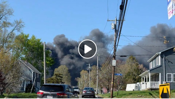
OURAY COUNTY, Colo. — A severe environmental and public safety emergency is aggressively expanding across southwestern Colorado as the out-of-control Gold Mountain Fire surges to 24,914 acres with 0% containment. Driven by hot temperatures, single-digit humidity levels, and intense wind gusts operating under prolonged Red Flag Warnings, the fast-moving blaze has triggered multi-county mandatory evacuations and heavily blanketed the region in dangerous smoke screen hazards.
The lightning-caused wildfire initially sparked on June 27, 2026, on private land just below the Gold Mountain Ranch off County Road 14, approximately two miles northeast of the City of Ouray. Over the last 48 hours, erratic wind-driven behavior has forced massive walls of flames across high-altitude mountain ridgelines, racing up Baldy Mountain and advancing deep into the Cow Creek drainage toward the southwestern Gunnison County line near Owl Creek Pass.
Expanding Evacuations and Multi-Agency Safety Directives
The rapid, northern and easterly progression of the inferno has prompted the Ouray County Sheriff’s Office to strictly enforce mandatory Level 3 “Go” evacuation orders across numerous residential zones. Over 530 emergency personnel, managed by the Rocky Mountain Complex Incident Management Team 3, are prioritizing life safety and structural point-protection strategies.
Official Incident Command Directive: “The fire is displaying extreme behavior with short-range spotting and heavy fuel consumption along rugged, vertical topography. Ground crews are working tirelessly to hold boundaries, but public safety remains our absolute priority. Evacuate immediately if your zone is called.”
Incident Metric         Current Data & Tactical Status
----------------------------------------------------------------------------------
Total Burned Area       24,914 Acres Affected (Mapping lines expanding)
Containment Level       0% Contained
Responding Forces       539+ Personnel, Heavy Dozers & Multi-State Air Tankers
Primary Shelter Hub     Ridgway Secondary School (1200 Green St.)
Livestock Evacuations   Montrose County Fairgrounds (Up to 68 horse stalls)
The fire’s intense heat previously destroyed a critical communication tower on Gold Mountain, which has severely hampered localized cell phone service and initially disrupted the automated delivery of county emergency alerts.
Active Fire Perimeters and Localized Emergency Zones
Emergency management officials have established a comprehensive color-coded evacuation matrix across neighboring boundaries to protect mountain communities:
-
Mandatory Evacuation Orders (“Go”): Active for Ouray County Zones 12, 13, 25, 30, and 300. This includes all properties in Panoramic Heights, Lake Lenore, Peck’s trailer park, Cedar Hill Cemetery (East of Highway 550), and surrounding corridors along Cow Creek.
-
Pre-Evacuation Warnings (“Set”): Enforced for southwest Gunnison County Zone 33 (east of CR-864A and west of Big Blue Creek) and portions of Ouray County. Residents here must stay tightly prepared to pack up and flee at a moment’s notice.
-
Voluntary Advisories (“Ready”): Maintained for Gunnison County Zone 32, Montrose County Zone 34, and Ouray County Zones 11 and 31, including areas adjacent to Buckhorn Lakes.
For public and crew protection, the Grand Mesa, Uncompahgre, and Gunnison (GMUG) National Forests have issued an emergency closure order restricting access to all public lands, trails, and backcountry campsites east of Highway 550 and south of Highway 50.
Transit Realignment and Holiday Community Impact
The massive proximity of the Ouray fire today has severely altered regional holiday itineraries and local thoroughfare transit. The Colorado Department of Transportation (CDOT) has managed to open U.S. Highway 550 to restricted through-traffic between Ouray and Ridgway (Mile Points 94 to 96), but strictly prohibits any stopping or standing on the shoulders. Law enforcement alerts indicate that secondary routes, including the entirety of Ouray County Road 14, remain tightly blockaded.
While the historic downtown core of the City of Ouray officially remains open to visitors, municipal leaders have heavily modified the traditional Fourth of July schedule and canceled several outdoor festivities due to hazardous air quality indexes and the ongoing emergency mobilization. Travelers are strictly warned to rely solely on COtrip.org and official county maps rather than digital navigation apps, which may mistakenly direct passenger vehicles onto rugged, unpaved 4×4 mountain passes that bypass active emergency zones.
As this fast-moving environmental crisis, heavy aerial suppression push, and multi-county evacuation grid continues to develop, check back regularly for updated perimeter boundaries, containment timelines, and breaking safety alerts from Colorado emergency officials.
ouray fire today, gold mountain fire coloray, ouray county sheriff evacuation map, lake lenore mandatory go order, highway 550 road closure co