Breaking News Update
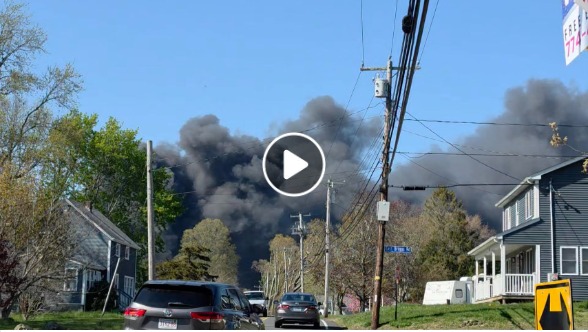
DENVER, Colo. — A historic and devastating environmental catastrophe is rapidly unfolding across the state as critical Colorado fires today have scorched more than 160,000 combined acres. Fueled by extreme heat, bone-dry winter deficits, and fierce, erratic wind gusts reaching up to 100 mph, multiple out-of-control blazes are actively threatening mountain communities, forcing mass structural evacuations, and triggering emergency disaster declarations.
The early-season crisis took a deeply tragic turn following a severe “burnover” incident on the Knowles Fire near the Colorado-Utah border, where three wildland firefighters tragically lost their lives after flames overtook their unit. Governor Jared Polis and regional Incident Management Teams have mobilized maximum federal assets—including multi-state hand crews, heavy dozers, and a massive fleet of large air tankers—to secure volatile perimeters under persistent Red Flag Warnings.
Expanding Evacuations and Urgent Multi-County Safety Measures
Extreme fire behavior has triggered a massive, multi-agency emergency response across both the Front Range and the Western Slope. Mandatory Level 3 evacuation orders are tightly enforced across dozens of subdivisions as fast-moving flames directly compromise local infrastructure and private properties.
Official Regional Command Directive: “We are facing historic, unprecedented fuel dryness and extreme weather cycles across the state. Ground crews are working aggressively on point-protection wrap and defensive line establishment. We urge all citizens to obey localized roadblock perimeters instantly.” — Multi-Agency Incident Briefing.
To help protect displaced families, regional emergency management teams have established active shelter hubs and Disaster Assistance Centers providing food, medical aid, and animal triage. Due to dense smoke columns blanketed across urban corridors, state health administrators have issued severe air quality advisories, warning sensitive residents to stay indoors.
Active Wildfire Tracker and Containment Footprints
Incident command hubs are continuously analyzing real-time meteorological telemetry and satellite imaging to track active fire frontiers. Firefighters are operating under high stress to establish containment lines on the state’s most pressing emergency scenes:
Active Incident         Acreage Affected    Containment Status & Primary Perimeters
----------------------------------------------------------------------------------
Aspen Acres Fire        50,187+ Acres       0% Contained | Pueblo/Custer County Line
Snyder Fire             30,193 Acres        65% Contained | Mesa County / Utah Border
Ferris Fire             28,801 Acres        10% Contained | San Juan National Forest
Gold Mountain Fire      21,788 Acres        0% Contained | Ouray County / Highway 550
Willow Fire             2,540 Acres         0% Contained | Lake County / Leadville Area
-
Aspen Acres Fire: Burning heavily along the breadth of the Wet Mountains, this massive inferno has destroyed up to 200 structures. Mandatory evacuations remain strictly in place for the towns of Rye, Beulah, and Wetmore.
-
Willow Fire: Situated just six miles west of Leadville, crews are aggressively conducting defensive firing operations near the Twin Mounds area to protect vital high-voltage power lines.
-
Gold Mountain Fire: Tearing through steep, rugged terrain northwest of Ouray, this zero-percent contained blaze continues to force Level 3 evacuations for Panoramic Heights, Lake Lenore, and Cow Creek.
Community Impact and Official Transit Resources
The intense regional impact of the Colorado fires today has crippled seasonal transit lines and shut down primary mountain thoroughfares. State Highways 165, 78, 67, and 96 are experiencing localized lane restrictions and total closures to give heavy mechanical water tenders and incoming mutual aid fleets unhindered roadway access.
Local administrators are coordinating directly with the National Interagency Fire Center, InciWeb Incident System, and county emergency alert portals to distribute updated perimeter maps and air quality metrics. Furthermore, state fire marshals are pleading with the public to strictly observe all fire restrictions, as regional fuel moisture levels sit at dangerous, historic lows.
As this fast-moving environmental disaster, heavy containment push, and evacuation grid continues to develop, check back regularly for updated press releases, revised road closures, and breaking announcements from Colorado emergency management officials.
colorado fires today, aspen acres fire update 2026, active colorado wildfire map, leadville willow fire evacuation, ouray gold mountain fire containment