Breaking News Update
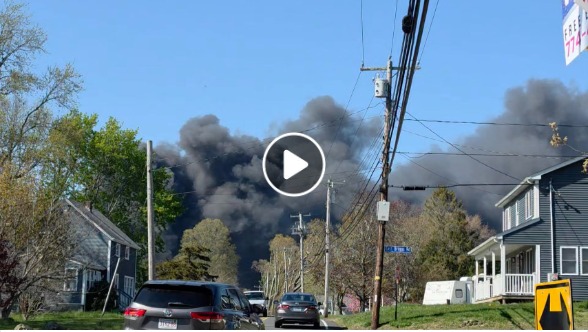
PUEBLO COUNTY, Colo. — A historic environmental and public safety crisis is rapidly expanding across southern Colorado today as the out-of-control Aspen Acres Fire surpasses 85,500 acres with 0% containment. The devastating blaze, which ignited on June 29, has officially become the ninth-largest wildfire in Colorado history and is currently the nation’s highest firefighting priority.
Fueled by severe drought conditions, extreme heat, and an unprecedented winter snow deficit, erratic wind gusts up to 40 mph have caused the fire to tear aggressively across the Pueblo and Custer County lines. Law enforcement officials confirm that at least 11,000 residents have been forced to flee their homes as the fire continues to threaten towns tucked along the Wet Mountains.
Expanding Evacuations and Urgent Safety Measures
The explosive movement of the fire overnight has triggered a massive, multi-agency emergency response. Mandatory evacuation orders are tightly enforced for the entire unincorporated community of Colorado City, alongside the towns of Beulah, Rye, and San Isabel.
Official Incident Command Briefing: “This fire is going to be with us for a long time. It is a very complex, rugged topography, and it is going to be impacting our communities for a while. We do not need one more spark this holiday weekend.” — Jim Pitts, U.S. Forest Service Agency Administrator.
To support heavily strained local law enforcement, approximately 50 Colorado National Guard soldiers have been deployed to man critical checkpoints and secure evacuated sectors. A dedicated Disaster Assistance Center has been established at the Pueblo Academy of Arts to provide food, shelter, and medical support to displaced families.
Active Fire Suppression and Strategic Footprint
More than 350 ground personnel, alongside the federal Alaska Complex Incident Management Team, are engaged in aggressive point-protection maneuvers. The tactical footprint relies heavily on specialized aerial assets, including large air tankers and scooper planes pulling thousands of gallons of water directly from the Pueblo Reservoir.
Incident Metric         Current Data & Tactical Status
--------------------------------------------------
Total Burned Area       85,585 Acres (134 Square Miles)
Containment Level       0% Contained
Structures Damaged      180+ Confirmed Destroyed (Expected to Rise)
Primary Evacuation Zones Rye, Beulah, Colorado City, San Isabel, Wetmore
Key Road Closures       State Highways 165, 78, 67, and 96
Ground operations are currently focused on fortifying firelines along the southwestern perimeter to prevent the flames from pushing deeper toward private property. However, fire marshals have expressed severe concern over a northern front that recently jumped Highway 165, dangerously approaching historic cabins and the popular local landmark Bishop Castle.
Statewide Community and Travel Impact
Beyond the immediate fire perimeter, the Aspen Acres Fire is creating widespread health hazards, sending dense plumes of dark smoke across the Front Range. Governor Jared Polis and state health administrators have issued an emergency air quality advisory, urging older adults, young children, and residents with chronic respiratory illnesses across central Colorado to stay indoors.
Initial forensic investigations indicate that the blaze was human-caused, though specific details remain strictly under investigation. Officials are pleading with the public to completely avoid the use of personal fireworks or campfires this weekend, warning that regional fuel moisture levels are at historic lows.
As this fast-moving disaster, containment effort, and evacuation grid continues to develop, check back regularly for updated perimeter maps, road closure releases, and breaking alerts from Colorado emergency management officials.
aspen acres fire today, colorado wildfire update 2026, colorado city evacuation, pueblo county sheriff fire map, wet mountains wildfire news